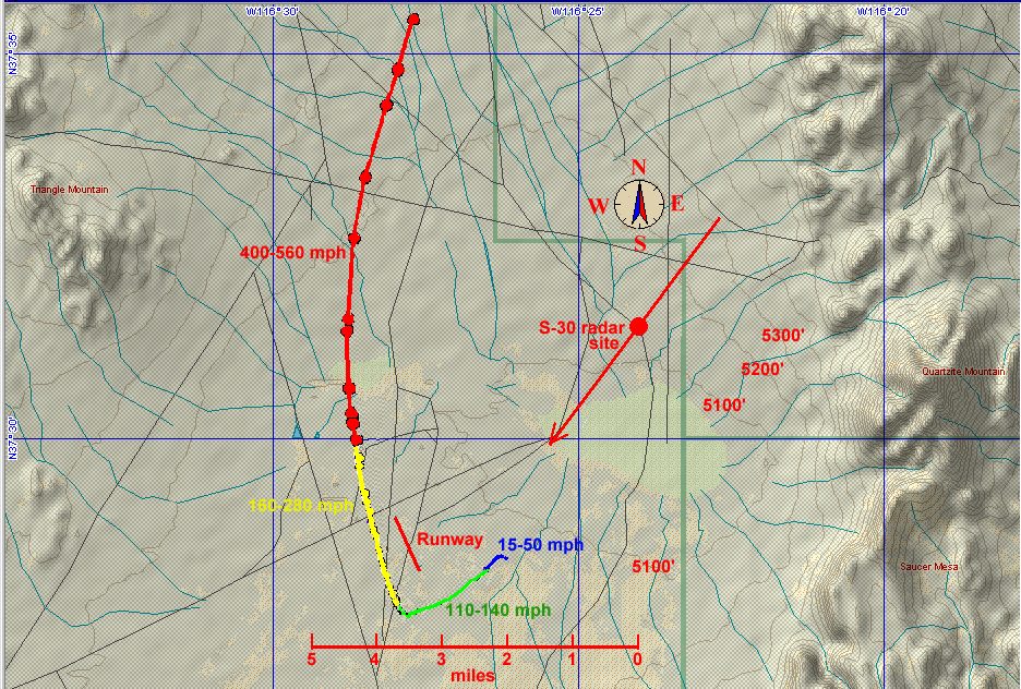
Nellis UFO Ground Trajectory
The UFO trajectory has been projected onto the ground and a topo map of region. Arrow through radar site location points to Black Mountain and 2 radar domes, 21 miles distant, visible at beginning of video while UFO is moving slowly near the ground. Ends of arrow represent uncertainty in actual distance from mountain and the true position of radar site. Note right angle turn may occur near lower end of a landing strip. The UFO speeds up, moves north, and rapidly gains altitude as it then circles the radar site, maintaining a precisely fixed distance of 5.7 miles. Different colors along trajectory represent different speed ranges, with sudden jumps occurring between ranges. Topographical map generated by TOPO U.S.A. program by DeLorme.